
A Terrier (from the French word “terroir“) is a survey list of all the lands (and sometimes other property) belonging to an estate. This particular document lists all the plots of land which John Southby held in the common fields of Aldbourne in 1690.
From the document we see that his estate (farm) was divided into no fewer than ninety eight separate pieces scattered all across the eastern and southern (common) parts of the parish from Peaks in the north to Stock Close in the south. It makes it abundantly clear why, in the 18th century, there was great pressure from farmers and landowners across the country to reorganise the common firleds into discrete farms. Here in Aldbourne Mr Southby and his like had to wait almost 120 years to see their dreams realised in the 1809 Enclosure Act.
You will notice that very few of these pieces of land are defined with reference to a fixed datum point; instead they are defined mostly by who held the adjacent plots. Sadly without a complete record of all the terriers of all the estates held in the Manor it is impossible now to be sure precisely where any of these plots was. On display in the Aldbourne Heritage Centre in 2020-21 is an estate map of Chase Farm from about 100 years later which shows the scattered acres that that farm held in the common fields and, interestingly, notes the holders of the adjacent plots.
Since the terrier lists all the adjacent plot holders, we have a good snapsuot of the farming families in the village at the end of the 17th century. Families such as Adee, Bacon, Brown, Chamberlain, Corr, Goddard, Knackstone, Looker, Mudge, Neal, Neate, Wilde and Witts are prominent and can be traced in the village through several generations.
Interesting too are the place names which appear – Castle Street was known as Calve Street; East Leaze, Ford Farm, Hillwood, Preston and Southwood Lane all had their modern names; Dores Grave was already known, as was Picked Cross which has only recently sunk into obscurity. But where were Anvil Knowle, Bullocks Acre, Cranch Acre, Dugemond, North Dickham and many others?
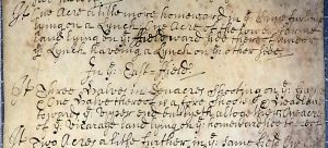
The document is written in English with the exception of the words Imprimis [= firstly] and Item [= similarly] and the statement of the date.
Note: We have retained the idiosyncratic spelling and capitalisation of the original. Three words, perhaps, need explanation: shoot[ing] – the meaning is rather unclear, but seems to be used in the sense of “adjacent to” or “towards”; Half or Halve – a measure of land of apparently of indeterminate or variable size (it does not appear to mean half an acre); Lynch – a flat terrace across a hillside formed by centuries of ploughing in one direction causing soil to move downhill (nowadays the word lynchet is preferred).
To view the Terrier, click here.
