
Aldbourne is situated in the Marlborough downs. The Chalk was formed in the Turonian Age (Upper Cretaceous), some of the surrounding hills have a cap of Head formed in the Quaternary Age.
Aldbourne sits at the junction of six valleys. One (South Street) is where the bourne leaves the village heading towards the Kennet. Another (Lottage Road) is where in wet winters the bourne rises. A third (West Street) can in very wet winters have flowing surface water (last seen in the very wet winter of 2013-2014).
The bourne normally rises in December or January, and flows until April or May. But this can vary a lot depending on the rainfall in the preceding period.
According to Ida Gandy a spring used to rise at the site of the pond in the centre of the village. It’s certainly easy to see how, when drainage was poorer and no water was abstracted from aquifers, how a spring would arise there, and how that in turn would have led to the settlement of the village.
It’s also worth noting that sarsen stone has formed in the valleys around the village (the Stonehenge sarsens came from the Marlborough area). Sarsen is an unusually young stone which forms in chalky stream beds (the common holes through sarsens would have been where roots were). Sarsen is also one of the strongest stones.
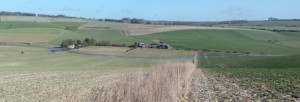
Fossils of sea urchins can be found amongst the red clay and flint that caps the hill to the south west of Preston
