
ALDBOURNE IN 1946
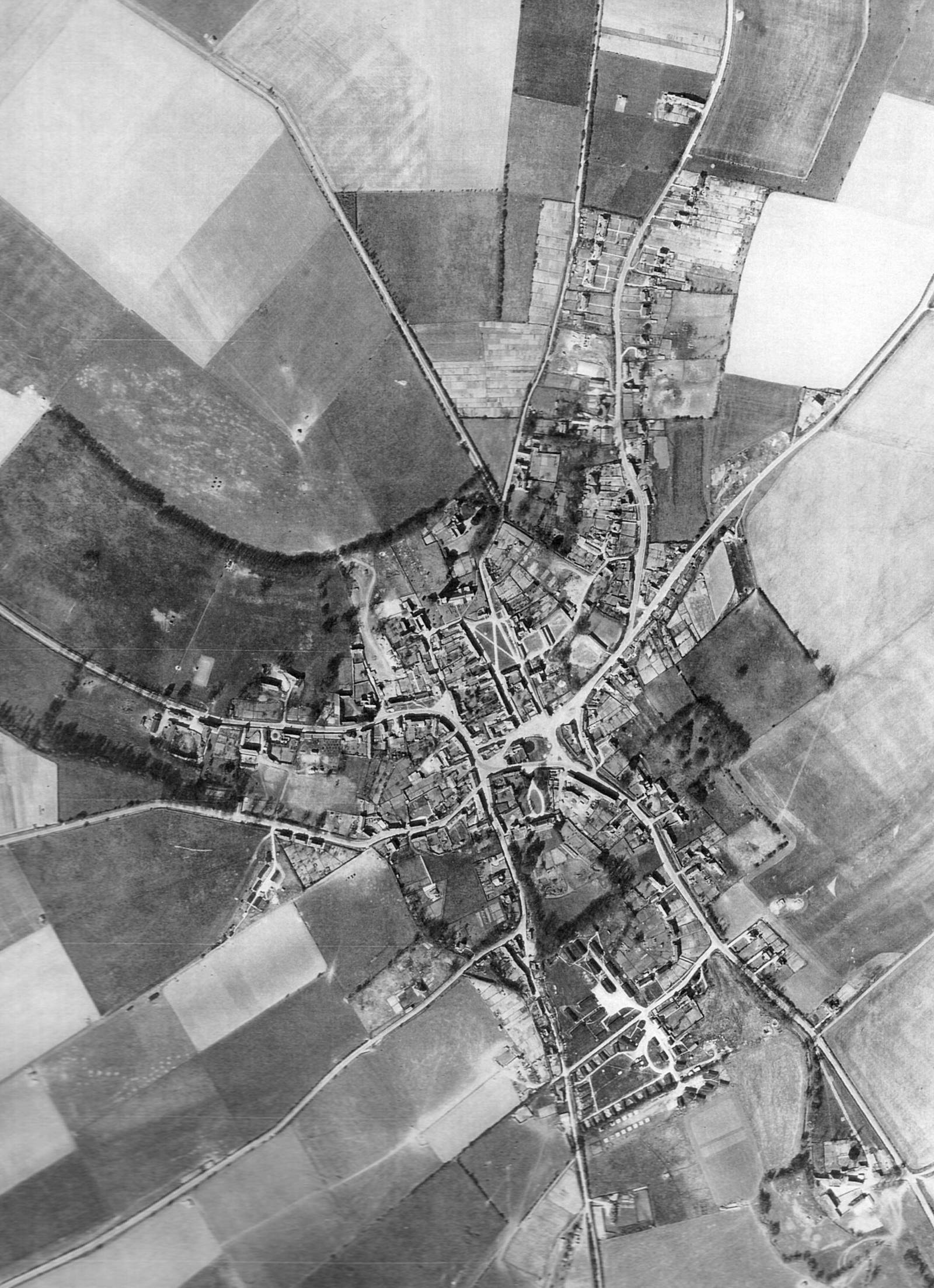
Aldbourne changed little over the hundred years to 1946 – the core of the village remained much as it was through Victoria’s reign.
The only signs of recent development are the houses along Lottage Road – semi-detached council houses to the west and private mostly detached houses and bungalows to the east – and the five pairs of council houses on the corner of Farm Lane and South Street, three of which have now been replaced by the Claridge Close development.
Notice that the Green still has its crossing paths and that the quarry alongside Baydon Hill is easily identifiable. The long shape of Glebe Barn is clearly visible along South Street, just to the east of the oval drive of the Old Rectory.
The stable blocks and paddocks of the Hightown racing stable can also be easily made out.
“Dig for Victory” had had its effect – the village was well endowed with allotments – between Grasshills and the Four Barrows track; opposite Westfield on Castle Street and all along above the backs of the cottages in the Butts.
The signs of the war are still very evident with the military encampment on Farm Lane very prominent. There were huts in Rectory Wood and where the later houses now are and the area of the football field and the near section of Palmers’ Field house two very clearly differentiated parts of the camp – rows of dormitory huts to the north and larger buildings to the south.
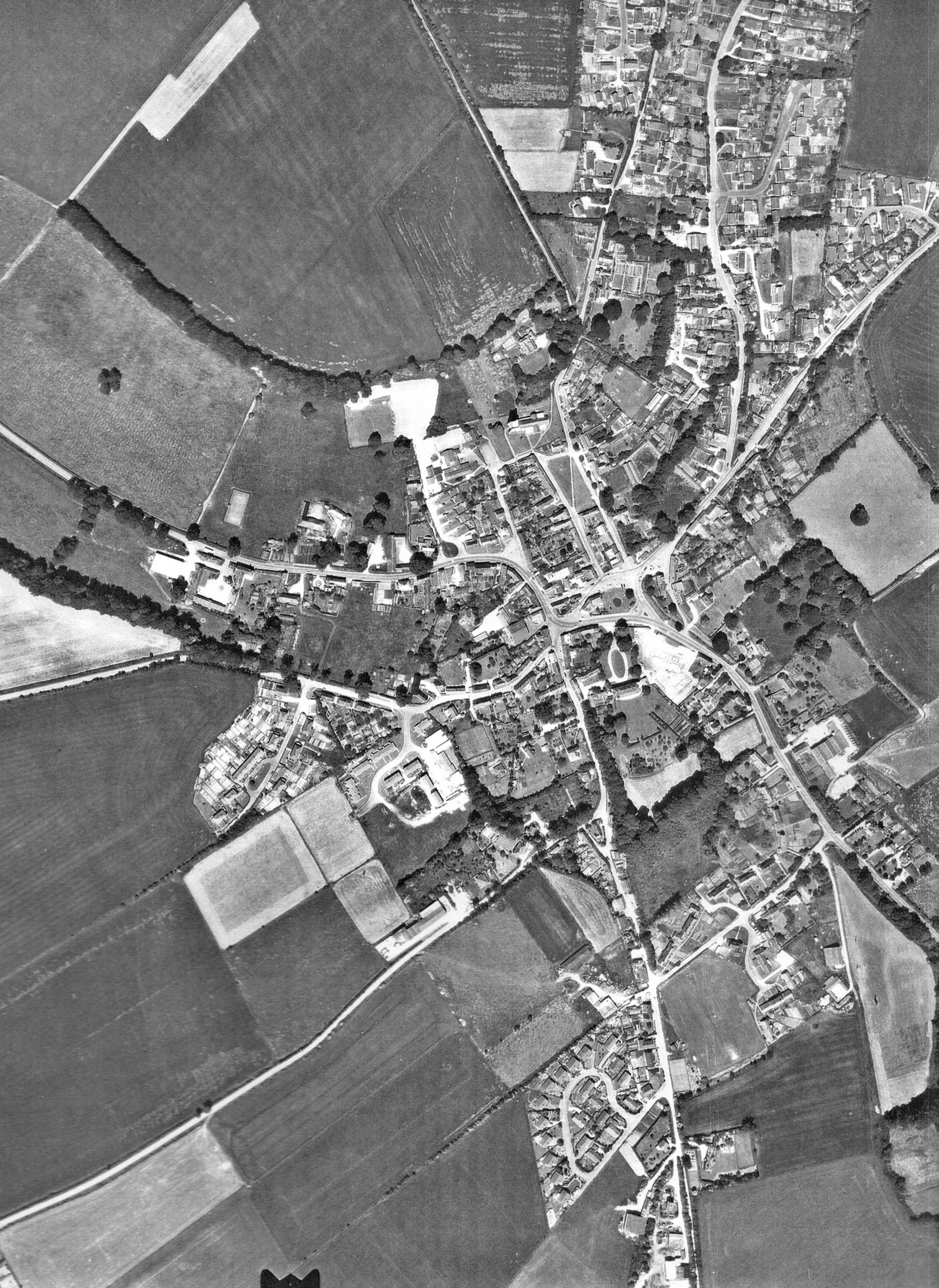
ALDBOURNE IN 1956

How little the village has changed in ten years! The army huts have gone from Farm Lane and Southward Lane but there are few signs of new development.
One house has appeared at the end of Lottage Road and a couple at the top of Baydon Hill. The Palmer family have built their house on South Street opposite Farm Lane and something seems to happening behind Lavender Cottage. A large building has appeared at the top of Marlborough Road and a couple of new houses have appeared in Westfield Chase.
The only significant development is the group of houses at the Butts end of Farm Lane which have been built on part of the old U.S.Army encampment. It also seems that the football field has started earning its name.
A curious new arrival is the track which has appeared running from the corner of Farm Lane to the west of Ford Farm. What did it lead to? And why has it disappeared?
Finally, in the ten years since 1946 the Green has lost the path which ran from the Church Gate to Hightown and it now has its familiar form.
ALDBOURNE IN 1972
What a difference the 1960s made! The village has almost doubled in size. Gone are almost all of the allotments whose digging brought us victory. Gone is the old Schoolhouse. Gone is the old Glebe Barn.
In their place are new houses on Grasshills, Cook Road, Cook Close, off the image to the north Alma Road and at the end of Lottage Road.
The green triangle between Lottage Road and Baydon Hill is now filled with Lottage Close, Kandahar and Windmill Close. And the old quarry has become home to half a dozen houses on Baydon Hill itself.
In the centre of the village the old school has been replaced by the new and, just to the west, St Michael’s Close has been built.
There are new buildings on South Street and up Southward Lane and the loop of the Garlings is clear. While further west, new houses have appeared around Westfield Chase.
Work still goes on: Hillwood and Whitley Roads are poised to spread into the fields to the west and in the centre of the village the white chalk and ghostly half-built footings mark the demise of Glebe Barn and the arrival of Glebe Close.
It must have been an extraordinarily busy time and, for native Dabchicks, probably a rather disturbing one. However, the worn goalmouth of the football field, and 3 new tennis courts testify to the vibrancy of the village and the vitality of the villagers.
